Frequent flyer John G. Dungan made this comment on the post Your Representatives in Austin:
Frankly, at this juncture, it would make more sense to detour all through traffic on I-10 via Loop 375, up and over Transmountain. We have allowed the love of the automobile to ruin too many American cities.
The problem is that the Transmountain traverse entails a big climb, and those eighteen wheelers hate big climbs.
But never fear. TxDOT has another ace up its sleeve: The Borderland Expressway (nee Northeast Parkway). And the Borderland Expressway has that bitchin’ logo.
Project Purpose
TxDOT’s El Paso District is dedicated to enhancing regional mobility and traffic movement into and through the city of El Paso, TexasThe purpose of the proposed project is to address regional system linkage and system capacity by providing an alternate route to I-10. The proposed Borderland Expressway would complete a route around the northeast side of El Paso suitable for truck and other through traffic, diverting traffic from the city center.
Project Limits
The proposed Borderland Expressway Project (formerly Northeast Parkway project) would be a new location facility from Loop 375 (1.8 miles east of Railroad Drive Overpass) to FM 3255 (Martin Luther King, Jr. Boulevard), 0.5 miles south of the Texas/New Mexico State Line). It is approximately 10.8 miles in length.
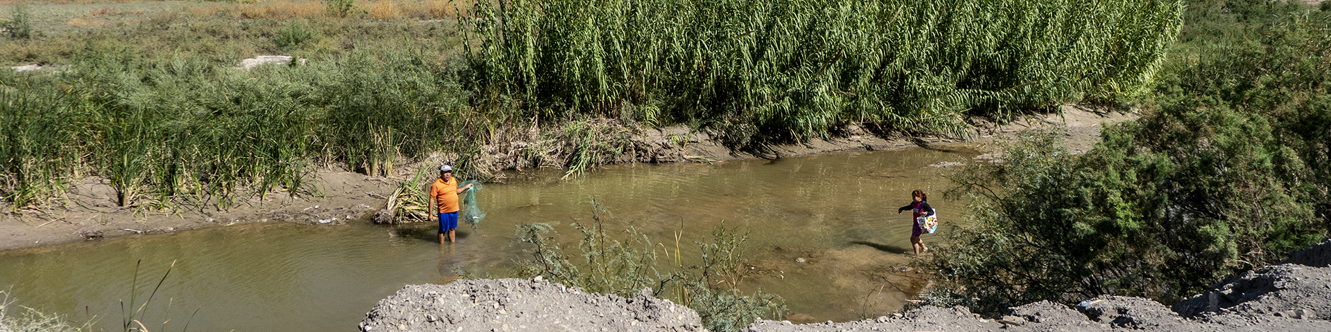
The proposed route takes the heavy traffic around El Paso and filters it through the Anthony Gap, reducing the number of big trucks driving through town just to get to someplace else.
Problem solved!
The drawback is that MountainStar Sports Group doesn’t get a deck it can put its soccer stadium on.
Oh well. We all have to make sacrifices. Unless you’re part of the billionaire class, and then you persuade the politicians to get the taxpayers make the sacrifices for you.
Just about every city in the country on the Interstate Highway System has a bypass. We don’t. A former city council rep once told me that El Paso doesn’t have a bypass because the person who owns the truck stops on existing I-10 doesn’t want it.
That thing about the truck stops might have been true many years ago. But, the major ones are now outside the city, and the existing Loop 375 is inside the city. And, it really is intended as a bypass. Every time there is something major blocking I-10, truck traffic is specifically guided to the Loop, by those big signs.
To above comment: Trucks should take Loop 375, easy access off I-10 and on again: runs more or less parallel to the Interstate.
So, is the Army on board giving up more maneuver training land? Is the city going to pass more Certificates of Obligation? (Yeah, I know any of these decisions are outside the scope of the city.) What about pushback from New Mexico to cover the cost for increased road usage?
Supposedly New Mexico’s on board. Federal highway funds! Whooeee!
There’s no intrustion on Ft. Bliss from either of these ideas. And, this is TXDOT, not the City! And, as Rich points out, federal highway money for New Mexico would be gladly accepted.
Loop 375 runs through Army property from Montana to the Railroad drive overpass. Why do you think there is an 8 foot tall chain link fence on both sides of the highway? This property extends several miles north of the CPB check point on US 54.
Did you look at the map? I don’t believe the Army is driving tanks within a nine iron of Railroad Drive. They’ve got plenty of land. They can afford to give some up on the fringes of Fort Bliss.
I know the terrain intimately as I support operations on Ft Bliss. The tank trail that parallels Railroad is discontinued for vehicle operations due to excessive dust created as units conduct maneuvers. This tank trail has been moved to the East a couple of miles but meets the original tank trail at the Otero County Detention Facility on US 54. The land in question is still used for vehicle operations (off of the tank trail) as well as dismounted maneuvers and bivouac locations in a tactical setting.
You might need to look at US Army doctrine and see exactly how much space a typical maneuver Brigade needs to conduct their assigned missions.
Then you must know that Fort Bliss is the Army’s second biggest installation. I reckon the Army’s maneuvers also occasionally encroach on White Sands, the Army’s biggest installation. Let’s not pretend that the Army doesn’t have plenty of terrain to play soldier.